|
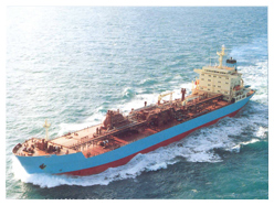
An ECDIS is a real-time Geographic Information System (GIS) that combines both chart and
sensor information into a real-time navigation tool. SOLAS compliance required installation
of ECDIS equipment on board ships in a phased manner with Mandatory Carriage date
depending upon the type, size (Gross Tonnage) and the date of keel laying of the vessel
commenced with High Speed Crafts by 1st July’2010, All Passenger ships (>500GT) by 1st
July’2014, All Tankers (>3000GT) by 1st July’2015 and All Cargo Ships by 1st July’2018
(> 3000GT built after 1st July’2014 and >10000GT built before 1st July’2013).
The refresher training is designed to impart up to date knowledge in various developments
in ECDIS, to the Deck Officers having IMO Model Course 1.27.
|
|
Understanding and interpretation of IMO ECDIS Performance Standards
IHO Standards that apply to ENCs and ECDIS Equipment including new standards implemented from 1st September 2017
ECDIS Statutory requirements regarding Certification, Training, Documentation and Record Keeping
Electronic and Raster Navigational Charts structure, ordering, installation, updating, associated problems and virus protection. Introduction to PAYS (Pay As You Sail)
Understanding ENC usage bands (Overview, General, Coastal, Approach, Harbour and Berth).
Inadequate and Non-ENC coverage areas, requirement of Appropriate Folio of Paper Charts (APC), Limitations of RCDS Mode
Safety Parameter, Look Ahead, Alarm configuration and setting for Anti-grounding.
Understanding and applying the Survey Accuracy represented by CATZOC and taking it into account for determining Minimum Depth Required (MDR) in Route Planning and Route Monitoring.
Identification and interpretation of Wreck, Rock, Obstruction as Isolated Danger symbols in Navigable as well as Non-navigable Waters on shallow side of Safety contour.
Route Planning and Monitoring guidelines having due regard to MARPOL, Environmentally Sensitive Sea Areas, Particularly Sensitive Sea Areas, Right Whale Areas etc.
Routes plan, User Map (Add Info) & Manual Update (Manual Correction) application and upload / transfer to networked ECDIS and/or External Media
Effective use of Route Check function during planning, before activation of Route at start of Voyage and during the Voyage particularly after application of Automatic and Manual update utilizing Chart Viewing Dates and schedule for considering Temporary & Preliminary corrections
Current status of inclusion of T & P Corrections in ENC, AIO Display, EP Corrections and their application.
|